Yarlung Tsangpo Grand Canyon
⭐ 4.70
Pai Town, Milin County, Tibet Autonomous Region, China
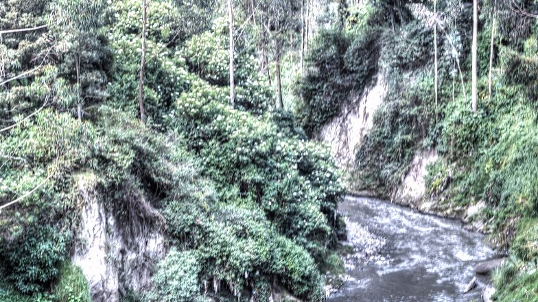 The Yarlung Tsangpo Grand Canyon was unknown to outsiders until 1994, when a team of Chinese scientists completed the first full traverse—a logistical feat rivaling the early Himalayan expeditions launched from British India in the 1920s. Carved over millions of years by the river that becomes the Brahmaputra upon entering India, the canyon stretches 504.9 kilometers and plunges over 6,000 meters at its deepest point. By European comparison, it is roughly three times deeper than Norway's fjords and longer than the Danube's entire course through Austria. The Yarlung name itself echoes Tibet's ancient royal dynasty, linking the landscape to over a millennium of regional history.
The canyon's defining feature is its great horseshoe bend, where the Tsangpo pivots sharply around Namcha Barwa, a 7,782-meter peak that has seen just one successful ascent in over three decades of attempts. This dramatic reversal of course matches the visual power of Switzerland's Verzasca Valley scaled up a hundredfold. The river's erosional force has sculpted one of the most powerful landscapes on Earth; downstream, its waters become the Brahmaputra, sustaining some 130 million people across India and Bangladesh.
Within the canyon's vertical walls, an entire climatic spectrum unfolds. Steamy subtropical rainforests at the river's edge give way to alpine meadows, glacial moraines, and permanent snow within just a few horizontal kilometers—a compression unmatched outside the Andes. Few European landscapes offer this; even the Italian Alps require a full day's drive to traverse similar vegetation changes. Each April and May, peach orchards along the lower slopes bloom against snowy peaks, earning the region its reputation as "China's most beautiful spring" and drawing photographers from across Asia.
Visitors can approach the canyon from multiple angles. Sightseeing buses link the entrance to key viewpoints, including a 1,600-year-old ancient mulberry tree and the Zhibi observation deck. Boats depart from Pai Township for Peach Blossom Island, drifting past mirror-still reflections of snow-capped peaks. A high-altitude hot-air balloon ride—rare in China—offers a bird's-eye view of Namcha Barwa's full profile when weather permits. Most travelers stick to the developed routes, preserving the canyon's sense of genuine expedition.
Entry costs 150 yuan per person, with sightseeing buses an additional 90 yuan. Plan at least one full day, ideally two, to do justice to the scale. The optimal window runs from April through October; September and October bring the clearest skies and the best chance of seeing Namcha Barwa in full. Most viewpoints sit between 2,800 and 3,500 meters, with surrounding passes exceeding 4,000 meters, so altitude sickness is a real consideration. Pack layered clothing, strong sunscreen, and patience for the slow-moving, glacier-fed weather.
Foreign visitors must arrange a Tibet Travel Permit through a registered Chinese travel agency before arrival, plus additional permits to reach nearby sites such as Basum Tso. Passports and permits are checked at the entrance, and all movement within Tibet's regulated tourism zones must be conducted through licensed guides. Confirm exact documentation requirements with your operator well in advance, as regulations shift frequently. The paperwork is genuinely cumbersome, but the payoff—standing above a canyon deeper than Mount Everest is tall—is unequalled anywhere else on the planet.
The Yarlung Tsangpo Grand Canyon was unknown to outsiders until 1994, when a team of Chinese scientists completed the first full traverse—a logistical feat rivaling the early Himalayan expeditions launched from British India in the 1920s. Carved over millions of years by the river that becomes the Brahmaputra upon entering India, the canyon stretches 504.9 kilometers and plunges over 6,000 meters at its deepest point. By European comparison, it is roughly three times deeper than Norway's fjords and longer than the Danube's entire course through Austria. The Yarlung name itself echoes Tibet's ancient royal dynasty, linking the landscape to over a millennium of regional history.
The canyon's defining feature is its great horseshoe bend, where the Tsangpo pivots sharply around Namcha Barwa, a 7,782-meter peak that has seen just one successful ascent in over three decades of attempts. This dramatic reversal of course matches the visual power of Switzerland's Verzasca Valley scaled up a hundredfold. The river's erosional force has sculpted one of the most powerful landscapes on Earth; downstream, its waters become the Brahmaputra, sustaining some 130 million people across India and Bangladesh.
Within the canyon's vertical walls, an entire climatic spectrum unfolds. Steamy subtropical rainforests at the river's edge give way to alpine meadows, glacial moraines, and permanent snow within just a few horizontal kilometers—a compression unmatched outside the Andes. Few European landscapes offer this; even the Italian Alps require a full day's drive to traverse similar vegetation changes. Each April and May, peach orchards along the lower slopes bloom against snowy peaks, earning the region its reputation as "China's most beautiful spring" and drawing photographers from across Asia.
Visitors can approach the canyon from multiple angles. Sightseeing buses link the entrance to key viewpoints, including a 1,600-year-old ancient mulberry tree and the Zhibi observation deck. Boats depart from Pai Township for Peach Blossom Island, drifting past mirror-still reflections of snow-capped peaks. A high-altitude hot-air balloon ride—rare in China—offers a bird's-eye view of Namcha Barwa's full profile when weather permits. Most travelers stick to the developed routes, preserving the canyon's sense of genuine expedition.
Entry costs 150 yuan per person, with sightseeing buses an additional 90 yuan. Plan at least one full day, ideally two, to do justice to the scale. The optimal window runs from April through October; September and October bring the clearest skies and the best chance of seeing Namcha Barwa in full. Most viewpoints sit between 2,800 and 3,500 meters, with surrounding passes exceeding 4,000 meters, so altitude sickness is a real consideration. Pack layered clothing, strong sunscreen, and patience for the slow-moving, glacier-fed weather.
Foreign visitors must arrange a Tibet Travel Permit through a registered Chinese travel agency before arrival, plus additional permits to reach nearby sites such as Basum Tso. Passports and permits are checked at the entrance, and all movement within Tibet's regulated tourism zones must be conducted through licensed guides. Confirm exact documentation requirements with your operator well in advance, as regulations shift frequently. The paperwork is genuinely cumbersome, but the payoff—standing above a canyon deeper than Mount Everest is tall—is unequalled anywhere else on the planet.