Gobi Desert
⭐ 3.80
Gobi Desert, Delingha City, Haixi Prefecture, Qinghai Province, China
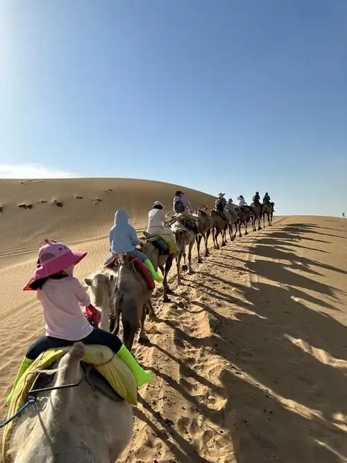 The Qaidam Basin sits in the northeast shadow of the Tibetan Plateau, a vast tectonic depression born from the same continental collision that raised the Himalayas roughly 50 million years ago. Unlike the Sahara or the Namib, where ancient trade caravans once crossed, this high-altitude cold desert was never a populous thoroughfare, though Silk Road branches skirted its edges. Today it functions as a natural laboratory for climate scientists studying how arid landscapes evolve, offering travelers a chance to walk across ground shaped by the same forces that uplifted the Andes.
Heidu Mountain (Black Lonely Mountain) anchors the visual drama, its dark volcanic ridges unfolding like ink wash paintings that recall the basalt cliffs of Iceland's Mývatn region or Northern Ireland's Mourne Mountains. Nearby, Yanzhi Mountain (Rouge Mountain) explodes in rust-red and ochre striations reminiscent of Utah's Vermilion Cliffs or Arizona's Antelope Canyon, but on a far more massive, untrammeled scale. Together these formations showcase how mineral-rich sediments oxidize into painterly landscapes untouched by human hands.
The crown jewel is Wusute Water Yardang, the only known yardang field on Earth where wind-carved sandstone spires rise directly from shallow turquoise water, evoking a flooded Cappadocia or a petrified Venice. Equally striking, the Emerald Lakes, including the famed Dachaidan and Mangya versions, owe their impossible green hues to dissolved minerals, much like Bolivia's Salar de Uyuni or Spain's Río Tinto, though framed by stark desert horizons rather than tropical mountains. Aiken泉 (Eye of the Earth) adds another surreal note, a sulfur-laden spring bubbling from ochre terraces like a Martian hot spring.
This is emphatically a self-drive destination, and Highway 315's viral "U-Road" has become a pilgrimage route for road-trippers, the kind of cinematic straight-line horizon that recalls Nevada's Extraterrestrial Highway. The abandoned Lenghu Oil Town, with its rusting Soviet-era drilling rigs and Mars Simulation Camp, cements the extraterrestrial mood, drawing comparisons to Chile's Atacama or Namibia's NamibRand, both designated Dark Sky Reserves. Plan two to three days minimum along the classic loop: Dachaidan Emerald Lake → Highway 315 → Water Yardang → Lenghu Mars Camp → Mangya Emerald Lake → Aiken Spring.
The best season runs May through October, with August offering slightly greener vegetation but warmer temperatures; winters plunge well below minus 20°C and roads close. Independent foreign travelers should join a licensed tour operator with proper vehicles, as signal dead zones stretch for hours, fuel stations are sparse, and border-management permits are occasionally required near Mangya. Pack high-SPF sunscreen, UV-blocking sunglasses, lip balm, and a windproof shell, since UV intensity at this altitude rivals the equator and temperature swings of 25°C between day and night are common.
Above all, respect the fragility: this is a high-desert ecosystem where footprints linger for decades, vegetation regenerates at glacial speed, and the silence itself is part of what you're paying to experience. Bring extra water, a power bank, and patience. The reward is a landscape that feels older than memory, a palette no filter can fake, and a sky so dark the Milky Way casts visible shadows, an experience increasingly impossible to find in our crowded world.
The Qaidam Basin sits in the northeast shadow of the Tibetan Plateau, a vast tectonic depression born from the same continental collision that raised the Himalayas roughly 50 million years ago. Unlike the Sahara or the Namib, where ancient trade caravans once crossed, this high-altitude cold desert was never a populous thoroughfare, though Silk Road branches skirted its edges. Today it functions as a natural laboratory for climate scientists studying how arid landscapes evolve, offering travelers a chance to walk across ground shaped by the same forces that uplifted the Andes.
Heidu Mountain (Black Lonely Mountain) anchors the visual drama, its dark volcanic ridges unfolding like ink wash paintings that recall the basalt cliffs of Iceland's Mývatn region or Northern Ireland's Mourne Mountains. Nearby, Yanzhi Mountain (Rouge Mountain) explodes in rust-red and ochre striations reminiscent of Utah's Vermilion Cliffs or Arizona's Antelope Canyon, but on a far more massive, untrammeled scale. Together these formations showcase how mineral-rich sediments oxidize into painterly landscapes untouched by human hands.
The crown jewel is Wusute Water Yardang, the only known yardang field on Earth where wind-carved sandstone spires rise directly from shallow turquoise water, evoking a flooded Cappadocia or a petrified Venice. Equally striking, the Emerald Lakes, including the famed Dachaidan and Mangya versions, owe their impossible green hues to dissolved minerals, much like Bolivia's Salar de Uyuni or Spain's Río Tinto, though framed by stark desert horizons rather than tropical mountains. Aiken泉 (Eye of the Earth) adds another surreal note, a sulfur-laden spring bubbling from ochre terraces like a Martian hot spring.
This is emphatically a self-drive destination, and Highway 315's viral "U-Road" has become a pilgrimage route for road-trippers, the kind of cinematic straight-line horizon that recalls Nevada's Extraterrestrial Highway. The abandoned Lenghu Oil Town, with its rusting Soviet-era drilling rigs and Mars Simulation Camp, cements the extraterrestrial mood, drawing comparisons to Chile's Atacama or Namibia's NamibRand, both designated Dark Sky Reserves. Plan two to three days minimum along the classic loop: Dachaidan Emerald Lake → Highway 315 → Water Yardang → Lenghu Mars Camp → Mangya Emerald Lake → Aiken Spring.
The best season runs May through October, with August offering slightly greener vegetation but warmer temperatures; winters plunge well below minus 20°C and roads close. Independent foreign travelers should join a licensed tour operator with proper vehicles, as signal dead zones stretch for hours, fuel stations are sparse, and border-management permits are occasionally required near Mangya. Pack high-SPF sunscreen, UV-blocking sunglasses, lip balm, and a windproof shell, since UV intensity at this altitude rivals the equator and temperature swings of 25°C between day and night are common.
Above all, respect the fragility: this is a high-desert ecosystem where footprints linger for decades, vegetation regenerates at glacial speed, and the silence itself is part of what you're paying to experience. Bring extra water, a power bank, and patience. The reward is a landscape that feels older than memory, a palette no filter can fake, and a sky so dark the Milky Way casts visible shadows, an experience increasingly impossible to find in our crowded world.