Ili River Valley
⭐ 4.80
Ili River Valley, Ili Kazakh Autonomous Prefecture, Xinjiang Uyghur Autonomous Region, China
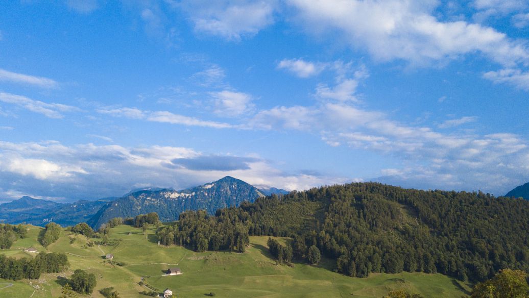 Geologically, the Ili Valley is one of Central Asia's most distinctive landforms. Bordered by the Tian Shan to the north, east, and south, and open to the west, it captures moist air masses drifting inland from the Atlantic Ocean across thousands of kilometers. This creates a humid continental climate unusual for the region, supporting roughly 16% forest cover, juniper stands, and rare wild walnut groves. Comparable in feel to an Alpine valley such as the Engadin in Switzerland, it stands in stark juxtaposition to the Taklamakan and Gobi deserts just beyond the mountain walls.
The landscape is structured as a "three mountains, two valleys" system divided by the Wusun and Awulale ranges. The Ili River itself is Xinjiang's largest by volume, flowing westward past towns such as Yining, Huocheng, and Zhaosu. This water wealth produces spectacular vertical zonation: glacier-capped peaks give way to forested slopes, then to the celebrated "human-body" curved grasslands of Kalajun and the sweeping skies of Nalati. Imagine the grandeur of the Scottish Highlands married to the alpine pastures of the Dolomites, with the added drama of the ancient Shata glacier trail cutting toward the Tian Shan heartland.
Human history runs deep here. The valley fell within the Western Regions Protectorate of the Han Dynasty around the 2nd century BC, placing it on the same Silk Road network that connected Chang'an to Rome. By the 18th century, the Qing Dynasty had established the Ili General's headquarters at Huiyuan Old Town, whose remarkably preserved walls and gates still evoke the architecture of a frontier imperial outpost. Nearby Tekes is laid out according to the eight trigrams of the I Ching, making it arguably the world's only functioning city without traffic lights, a curiosity to compare with the planned medieval bastides of southern France.
Culturally, the valley remains one of Xinjiang's most vibrant crossroads. Yining's Kazanqi folk village and the pastel-blue houses of Liuxing Street reflect a layered heritage of Uyghur, Kazakh, Hui, and Han communities living side by side. Markets overflow with hand-pulled noodles, fermented mare's milk, and felt yurts, while evening gatherings often feature the Kazakh dombra lute, an instrument distantly related to the Central Asian kobyz tradition.
The best time to visit is June through August, when alpine wildflowers and lavender hit their peak and Zhaosu's vast fields of rapeseed and sunflowers turn gold. Adventurous travelers can self-drive the legendary Duku Highway or the more remote Yizhao Road across the Tian Shan, ride horseback into the high pastures, or trek the historic Shata trail toward its hanging glaciers. Travelers heading to the Shata interior or the Huochergos border cooperation zone must carry a Border Management Area Permit. Given the vast distances and varying road conditions, hiring a private vehicle with a local guide is strongly recommended for a rewarding journey.
Geologically, the Ili Valley is one of Central Asia's most distinctive landforms. Bordered by the Tian Shan to the north, east, and south, and open to the west, it captures moist air masses drifting inland from the Atlantic Ocean across thousands of kilometers. This creates a humid continental climate unusual for the region, supporting roughly 16% forest cover, juniper stands, and rare wild walnut groves. Comparable in feel to an Alpine valley such as the Engadin in Switzerland, it stands in stark juxtaposition to the Taklamakan and Gobi deserts just beyond the mountain walls.
The landscape is structured as a "three mountains, two valleys" system divided by the Wusun and Awulale ranges. The Ili River itself is Xinjiang's largest by volume, flowing westward past towns such as Yining, Huocheng, and Zhaosu. This water wealth produces spectacular vertical zonation: glacier-capped peaks give way to forested slopes, then to the celebrated "human-body" curved grasslands of Kalajun and the sweeping skies of Nalati. Imagine the grandeur of the Scottish Highlands married to the alpine pastures of the Dolomites, with the added drama of the ancient Shata glacier trail cutting toward the Tian Shan heartland.
Human history runs deep here. The valley fell within the Western Regions Protectorate of the Han Dynasty around the 2nd century BC, placing it on the same Silk Road network that connected Chang'an to Rome. By the 18th century, the Qing Dynasty had established the Ili General's headquarters at Huiyuan Old Town, whose remarkably preserved walls and gates still evoke the architecture of a frontier imperial outpost. Nearby Tekes is laid out according to the eight trigrams of the I Ching, making it arguably the world's only functioning city without traffic lights, a curiosity to compare with the planned medieval bastides of southern France.
Culturally, the valley remains one of Xinjiang's most vibrant crossroads. Yining's Kazanqi folk village and the pastel-blue houses of Liuxing Street reflect a layered heritage of Uyghur, Kazakh, Hui, and Han communities living side by side. Markets overflow with hand-pulled noodles, fermented mare's milk, and felt yurts, while evening gatherings often feature the Kazakh dombra lute, an instrument distantly related to the Central Asian kobyz tradition.
The best time to visit is June through August, when alpine wildflowers and lavender hit their peak and Zhaosu's vast fields of rapeseed and sunflowers turn gold. Adventurous travelers can self-drive the legendary Duku Highway or the more remote Yizhao Road across the Tian Shan, ride horseback into the high pastures, or trek the historic Shata trail toward its hanging glaciers. Travelers heading to the Shata interior or the Huochergos border cooperation zone must carry a Border Management Area Permit. Given the vast distances and varying road conditions, hiring a private vehicle with a local guide is strongly recommended for a rewarding journey.